Monday, 31 October 2011

2nd October 2011 Leckhampton Hill, Glos

This was a walk done many times before, starting out at my front door and making a circular trip around and up Leckhampton Hill and back. This is a 6.5 mile walk which takes around 2-3 hours depending on the pace and the company!

This time it was done with Mike, Liz, Geoff, Shona, Dean and Trudy, plus two friends (Rich & Flick?) from his apartment building - 9 in all, a record!


We left Croft Street, following streets up to Burrows Field, then through Leckhampton village, Collum End Rise and then up through fields towards Daisy Bank Road. The stretch from the fields to Daisy Bank Road follows the old tram track which used to take quarry stones down to the tram terminus at the Norwood Triangle. 


Norwood Triangle


We followed the road, passed the car parks for walkers, bikers and dog walkers and headed along, past houses on Our left until the road, which has turned into a track, meets the extension of Sandy Lane in Charlton Kings. We turned right along the track towards Seven Springs and past Lilley Brook golf club on our left until we joined the Cotswold Way, turning right up the escarpment to walk along the hill top. The new dry stone wall (see previous walks e.g. 17th March 2011) is now complete and looks marvellous. We then followed the escarpment with great views of Cheltenham and beyond.


Devil's Chimney
The escarpment with the new dry stone wall on the left, leads to the highest point on the Cotswold Way (925 ft) and has great views over the town and as you follow the track, you can also see the various hills towards to Malverns and even the Black Mountains in Wales. It is a site of Iron Age hill fort and long barrow and famous for its old limestone quarries. Old tramway lines criss-cross the hill from the days of limestone quarrying and the remains of kilns and quarries are still very much in evidence. It is a site with a great deal of cultural and historical significance as much of the stone removed from the quarry on the Hill was used for buildings in Cheltenham - and also parts of Magdalen College, Oxford. 


The track leads past the Devil's Chimney, a substantial pillar of stone left standing next to one of the upper inclines, but nothing is known as to who left it there or why. 


Just after the chimney, we stopped for a team photo and once done, we started downhill with a choice of routes. The quickest is to follow the old tramway path but this is quite steep, so we opted for the more leisurely descent towards the car park where I re-joined Daisybank Road and the tramway path which we'd followed on the way up. We re-traced my steps over farmland, Collum End Rise and Burrows Field before getting home, showering and racing to the Jolly Brewmaster for refreshments.


An OS view walk is below, courtesy of QUO digital mapping/OS

28th September 2011 Fostons Ash to Sheepscombe, Glos

This was a Wednesday morning walk with Mike which I'd done previously with Robin and Liz. It is a pleasant 5 miler taking a couple of hours with the opportunity for a (longer) stop at the Butchers Arms in Sheepscombe if required.

We parked at the Fostons Ash pub and made our way back along the road to Birdlip (B4070) , crossing to use the footpath in the bushes, until we reached the farm where we went through the gate and joined a path to the left, dropping down towards the woods.

Fostons Ash Pub & Restaurant, Nr Birdlip, Glos

We followed the track in the woods and were quickly away from the road noise in a lovely setting with banks of trees either side and bright sunshine. The track follows the valley floor with a number of paths criss crossing, but keeping to the main track we admired the well kept woodlands managed by the National Trust and the Ebworth Centre. Eventually the track comes to some typical Cotswold houses on the edge of the picturesque Sheepscombe village. The track becomes a single track road as we passed more houses going to the centre of the village. The Butchers Arms pub is on the right and we stopped outside for liquid (water) intake and a snack - well this was before opening time! The weather was fabulous, bright sunshine and really warm, hardly the weather for late September.

Butchers Arms, Sheepscombe

Mike @Butchers Arms
Old Vicarage
After a short stop, we admired the old vicarage, turned sharply to the right and started to climb, passing more pleasant houses until we emerged at the top of the incline near the Sheepscombe cricket club - land donated by Laurie Lee and very picturesque indeed. We turned to the left, entering the wood called Lord's Wood and followed the track uphill, keeping straight ahead until we entered Saltridge Wood, keeping the open fields to our right. After Saltridge Common Wood we followed the track through open fields, heading more or less in a straight line towards the minor road to Cranham. When we reached the road, we turned right for a short while until we reached Overtown Farm where we left the road and followed a path across the field towards the entrance on the B4070 to the Ebworth Centre. We noticed that the farm had plenty of visitors to its organic meat outlet and I made a mental note to Google the farm to have a look.

Overtown Farm Organic Meat

We followed the B4070 back towards the Fostons Ash, keeping to the footpath behind the bushes and fired up the car for the return journey to Cheltenham.

An OS view walk is below, courtesy of QUO digital mapping/OS

Tuesday, 27 September 2011

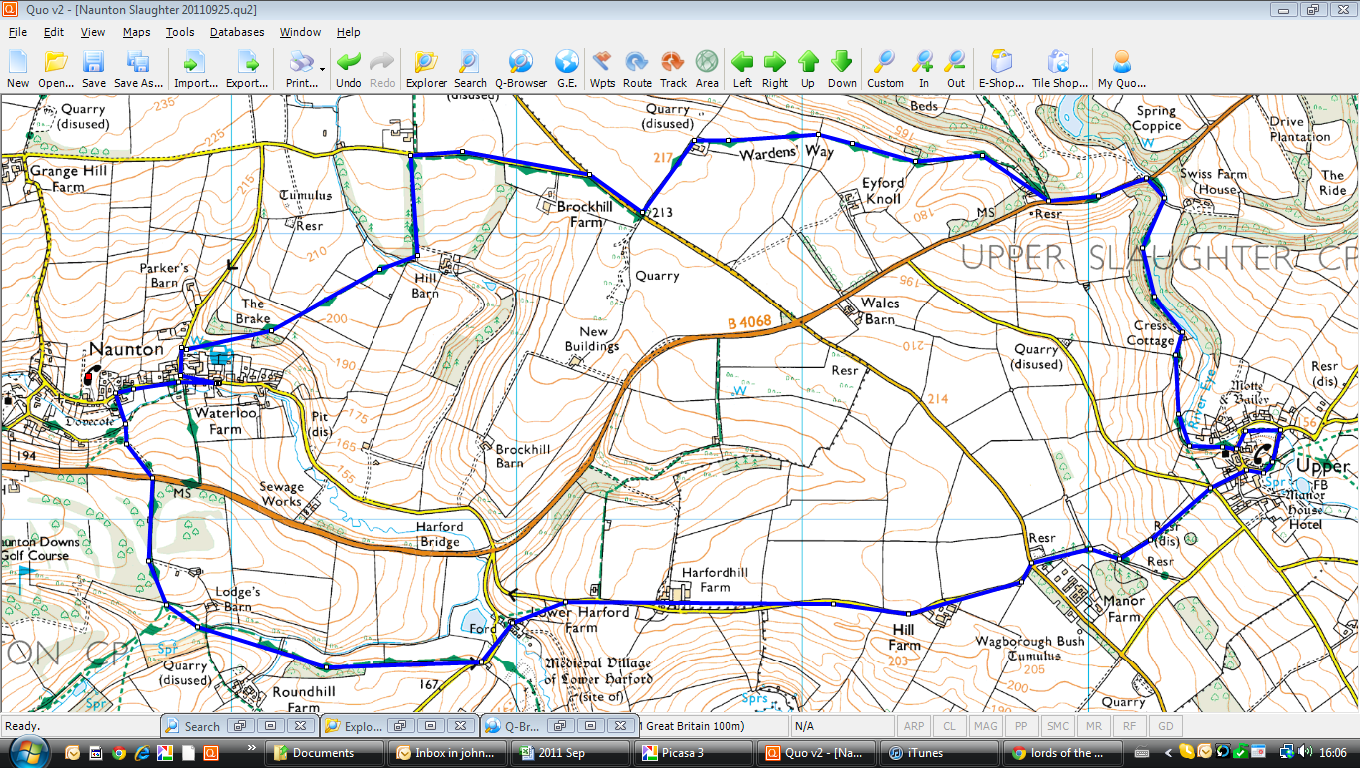
Sunday 25th September 2011 Naunton, Upper Slaughter, Glos

Mike & Robin
This was one of our traditional Sunday walks, done with Robin and Mike, but in Mike's favourite area around Naunton. Mike drove us from Cheltenham on a grey morning and we parked opposite the Black Horse pub, ready for the return later. The circular walk is 7 miles which we did in around 2.5 hours.

The Black Horse, Naunton

We walked back through the village and turned left beside the old dovecote (see walk of 9th March 2011 with Mike). We continued up the hill past the dovecote until we reached the golf course, keeping to the well defined track before turning to the left, across fields towards the ford at the Windrush. We met another group of walkers there who greeted us and when we told then we were doing a circular walk back to Naunton via Upper Slaughter, their leader scoffed, questioning our navigational skills. When we were out of earshot, we let them have it! But I think they heard - see later.

Lords of the Manor
We crossed the field, heading across and uphill until we reached tarmac and then followed the road for some time past farm buildings and other Cotswold gaffs. Beside Manor Farm, we entered fields again with the promise of a pit stop and coffee but the view that Mike had in mind for our stop was crowded out by a blue rinse walking group who greeted us loudly as we approached! We eventually found some space (!), had our break and continued into Upper Slaughter, passing the Lords of the Manor and other pristine houses, turning left in the village to meet two bus-loads of ramblers, one from Derby. We admired the houses in the village, cursed the Londoners and made our way past the sea of humanity in walking boots.

We left the village along the track by the River Eye, through woodland until we met the road again - this time stopping to admire a handsome gate house for Eyford Park, before moving on for a short while before following the Wardens' Way track again. We passed a row of workers cottages before taking the track - I don't suppose these are for workers any more! The track at this stage is quite easy and we were making good time as the rain/drizzle came down, covering us very quickly. We followed the track in a zig-zag until we came to Brockhill Farm where we began our descent down to Naunton. We actually met our sceptical tour leader and his group coming the other way, apologising loudly and theatrically that he/they should never question other folks' navigational skills! Sorted!

We arrived back into Naunton in the rain, changed and enjoyed Donningtons BB and SBA beers with lots of other walkers!

An OS view walk is below, courtesy of QUO digital mapping/OS


Wednesday, 21 September 2011

Wednesday 21st September 2011 Hazleton & Salperton, Glos

This is a short (5 miles) circular walk through rolling Cotswold Hills, done with Mike on a beautiful autumn day, sun shining, birds singing etc etc. We drove to the picturesque village of Hazleton, just off the main A40 and parked in the village before setting off along the track down towards a large, untidy farm yard.

I was relieved to see that a large gaggle of geese were restrained behind a fence as we approached, so we took time, in comparative safety, to look at the geese, ducks and other game birds being reared there. We passed through the smelly farm yard and started along the edges of fields which had been recently been ploughed. We continued until we stopped to look at an old barn at Downs Barn which Mike had explored on a previous walk - believing it to be the home of barn owls at some stage.

Back towards Hazleton
We started uphill at this stage (unusual for a Mike walk) on a gentle climb, criss-crossing fields, trying to keep out of the muddy parts by sticking to the edges of the fields and stumbling through the narrow tracks as a result. We joined the Gloucestershire Way at Lamp Acre where there was a very smart roadway, with well manicured trees and bushes either side - marking the entrance to Salperton Park. We crossed the cattle grid into the park and took a small detour to look at a view of the main house before retracing our steps and continuing the walk back towards Hazleton.
Salperton Park
Again we crossed fields and skirted the woods at Hazleton Grove before we saw the first few houses of the village. We passed the churchyard, admired a few village houses before we reached the car and took on liquids. We declined a lunchtime pint and drove back to Cheltenham - a good walk and all done, door to door in around two hours.


An OS view walk is below, courtesy of QUO digital mapping/OS

Monday, 19 September 2011

Sunday 18th September 2011 North Cerney to Daneway, Glos

We were up very early for the England RWC match against Georgia, so a walk at 10:00 seemed a good idea. Jools dropped Robin, Mike, Liz and myself at North Cerney, near the Bathurst Arms and the plan was to walk via Sapperton to the Daneway pub where Jools would meet us. This walk is the reverse of a Robin walk he had devised and done with Mike some weeks earlier. The walk is around 7.74 miles and took us just under three hours with stops.

Duntisbourne Rouse
St Michaels
We started up the road towards Woodmancote with a steady incline, just right to get us puffing a little. We passed the picturesque cricket ground and continued to the village where we kept left on the Macmillan Way, passing Moor Wood Farm and heading for Dartley Farm where the loud hum of the A417 was getting louder. We stopped for a short while to pick Sloes for the next batch of sloe gin before going under the dual carriageway and heading off again on the Macmillan Way. We followed the track on the edges of field before coming to the ford at Duntisbourne Rouse and continued through the village, only stopping to have a quick look at the Anglo Saxon church of St Michael, while Rob & Mike, who had already done the tour, had a fag.

Duntisbourne Rouse, Glos

Daneway Entrance
Pinbury Park
Leaving the village, we again followed the track along the sides of field until he hit the road again, following it for a while before entering a fine park gateway leading into Pinbury Park. At this point the walk got really pleasant as we followed the track along the top of the hill with the valley below us and the fine houses to our right. Eventually, following the track and the horse poo, we dropped into the posh village of Sapperton and down to the canal where we followed another walking group to the Sapperton Tunnel.

Daneway entrance to Sapperton Canal Tunnel

We continued ahead of this group along the canal path towards the Daneway pub where we enjoyed Somersault beer and some sunshine before Jools picked us up and took us back to Cheltenham.

The Daneway Inn, Daneway, Glos

Rob, Mike, Liz
Ditto


An OS view walk is below, courtesy of QUO digital mapping/OS


Friday 22nd July 2011 Pen-y- Ghent, Yorkshire Dales

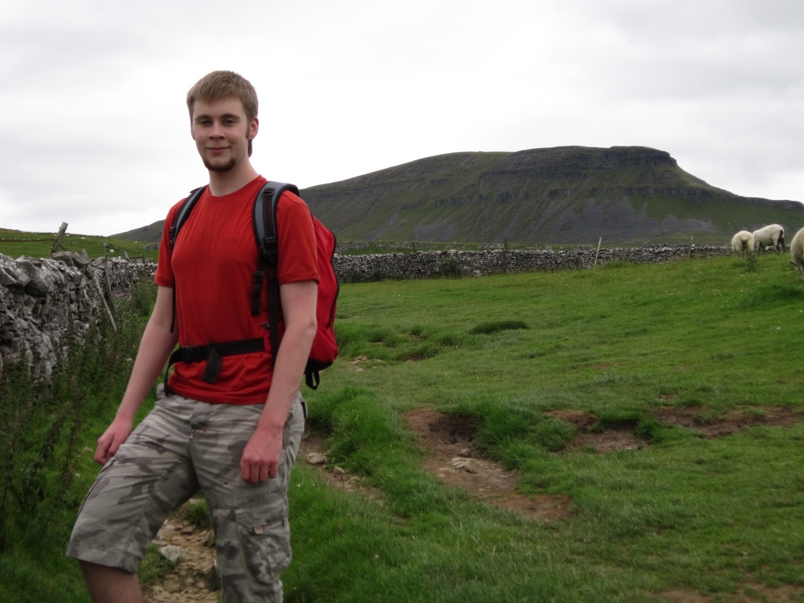
Dominic and I had completed two of the Yorkshire Peaks at the end of June, so this was an opportunity for us to do the third while D was in the Dales for a few days. The ascent to Pen-y-Ghent and the walk, following the Pennine Way route back to Horton, is a mere 6 miles but the first two of these miles are quite hard, so overall time would be around three hours.

We left Dent early in the morning, drove to Horton and parked in the public car park, before setting off on the now familiar trek towards the brooding peak of Pen-y- Ghent, which I had done in early June and more recently on the YTP Challenge.

We passed the Pen-y-Ghent cafe and turned by the church to follow the road up towards the farm at Brackenbottom where we started up the track. We followed the track in good weather and passed familiar points along the way, climbing the obstacles and gradually making our way up the incline with dry stone walls to our left. Eventually, we got to the large stile where the Pennine Way cuts across our path and we joined the track uphill, via steps and rough ground. It is at this point that it becomes quite steep so you're scrambling a little to make progress, but eventually we came onto a plateau where there is abut a short walk to the trig point and the summit.

We paused for a while to take on liquids and snacks before crossing the stile and heading downhill towards the long path back to Horton. We turned to the left after the descent, following the Pennine Way on a straight but uneventful track downhill before we made a left at Grouse Bar to continue the descent into Horton by way of Horton Scar - coming out onto the Horton main road near the cafe where we enjoyed hot drinks and bacon butties before heading back to Dent.


An OS view walk is below, courtesy of QUO digital mapping/OS

Thursday 21st July 2011 Dent, Yorkshire Dales

This was a walk around the lovely village of Dent in the Yorkshire Dales with Lynda and Dominic - a four mile loop, starting and ending in the centre of Dent, close to the church and pubs.

It was a lovely sunny morning when we set off from the rented cottage heading up the hill, through the village until the road turned into a cart track where we turned to the right, heading across fields and through farms towards Gawthrop, another scenic village perched on the side of the hill with great views towards the Lake District. There were also great views back towards Dent and Rise Hill as we walked through Gawthrop and towards the River Dee. We crossed the fields by Foulsyke Farm and joined the track by the river at Barth Bridge. From there, we followed the river only pausing to swat horse flies that were troubling us a little! We followed the track back towards Dent, passing the small campsite and reaching Church Bridge which crosses the main road from Dent to the railway station and Hawes via the narrow lanes.

At this stage we should have followed the Dales Way along the Dee, but instead traced the Keld, a small stream flowing from a number of nearby springs. We followed the track as far as Double Croft and then turned up the road to the right and reached the tarmac of Deepdale Lane which led us back to Dent and the comfort of the George & Dragon pub with its excellent Dent ales.


The George and Dragon, Dent

Dent Brewery


An OS view walk is below, courtesy of QUO digital mapping/OS